


Secondary sourceDocumentbetween 1725 and 1730 (printed later)
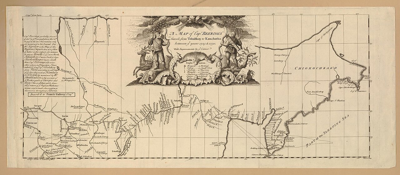
Map of Captain Beerings' Travels from Tobolskoy to Kamchatka
between 1725 and 1730 (printed later)
A printed map tracing Bering's route across Siberia to Kamchatka between 1725 and 1730, made from his expedition's surveys.
This map charts the route of Bering's own First Kamchatka Expedition across Siberia.
About this source
What it is
This is a printed engraved map showing the route of Captain Bering's travels across Siberia, from Tobolsk to Kamchatka, between 1725 and 1730. It is held by the British Museum and includes a decorative title cartouche with hunters, animals and wind-blown faces.
Why it matters
This map is based on the surveys made during Bering's First Kamchatka Expedition. Once printed and circulated in Europe, it helped spread knowledge of Siberia's geography and Bering's explorations far beyond Russia, shaping how Europeans understood the remote eastern edges of the continent.
Look closer
- Why might the mapmaker have added hunters and wind-blown faces around the title, rather than leaving it plain?
- What does the level of detail in place names tell you about how much was known of this region at the time?
- What parts of the journey does the map not show, and why might that be?
This document is part of the curated material that grounds the AI version of Vitus Bering on Humy.ai — when students ask about related events, the AI can quote it and cite it.
More Vitus Bering sources
Browse all 71 → Book
Secondary source
Bering's Voyages: An Account of the Efforts of the Russians to Determine the Relation of Asia and America
Frank A. Golder · 1922–1925
 Book
Secondary source
Vitus Bering: the Discoverer of Bering Strait
Peter Lauridsen · 1889
Primary source
Early Expeditions to the Region of Bering Sea and Strait
Vitus Bering · 1891 (translation of earlier reports)
 Document
Primary source
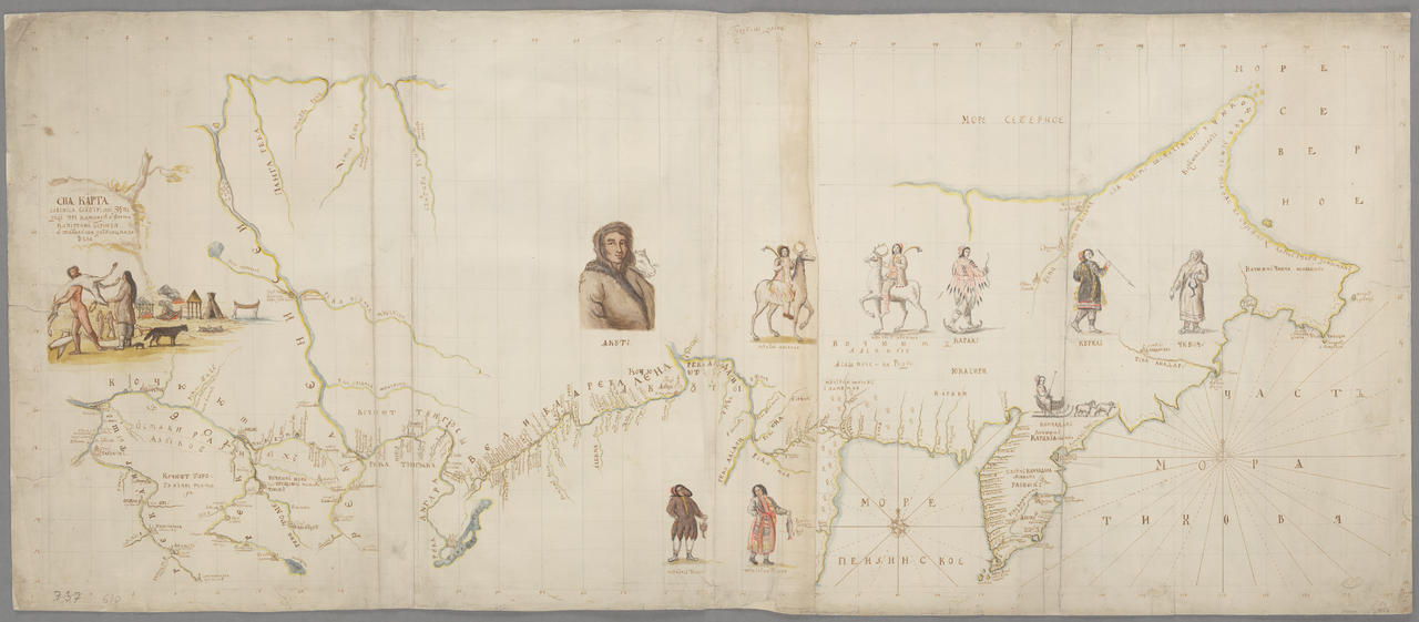
Chart of the Siberian Expedition under Bering, Tobolsk to Chukotka
Vitus Jonassen Bering · between 1725 and 1730
Free account
Browse every Vitus Bering source
Sign up free →
Ready when you are
Start chatting with Vitus Bering now.
20 messages free · No credit card · Available in 50+ languages.