


Secondary sourceDocument1759
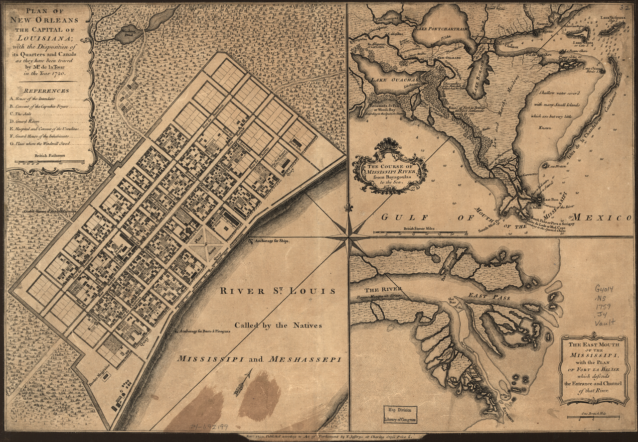
Plan of New Orleans as traced by de la Tour
Thomas Jefferys · 1759
An engraved map of New Orleans published in London in 1759, showing the city grid designed under Bienville, brother of Iberville, in the colony Iberville founded.
Shows the city founded by Iberville's brother in the Louisiana colony Iberville established.
About this source
What it is
This is an engraved map titled Plan of New Orleans the Capital of Louisiana, published in London in 1759 by Thomas Jefferys. It shows the grid of city blocks and canals, along with inset maps of the Mississippi River and its mouth.
The map is based on an earlier manuscript plan by Pierre Le Blond de la Tour, chief royal engineer in Louisiana, and shows the town designed under the direction of Jean Baptiste le Moyne, Sieur de Bienville.
Why it matters
New Orleans was founded by Bienville in the French colony of Louisiana, a colony first established by his brother, Pierre Le Moyne d'Iberville. The map shows how French colonists organized a new settlement, naming key buildings like the hospital and jails, and recording both French and indigenous names for the Mississippi River.
Look closer
- Why might the mapmaker have included both the French and indigenous names for the river?
- What does the careful grid design tell you about how the French planned their colonial towns?
- What is missing from this map that might tell a fuller story of the people living there?
This document is part of the curated material that grounds the AI version of Pierre Le Moyne d'Iberville and Jean-Baptiste Le Moyne de Bienville on Humy.ai — when students ask about related events, the AI can quote it and cite it.
More Pierre Le Moyne d'Iberville sources
Meet the AI Pierre Le Moyne d'Iberville →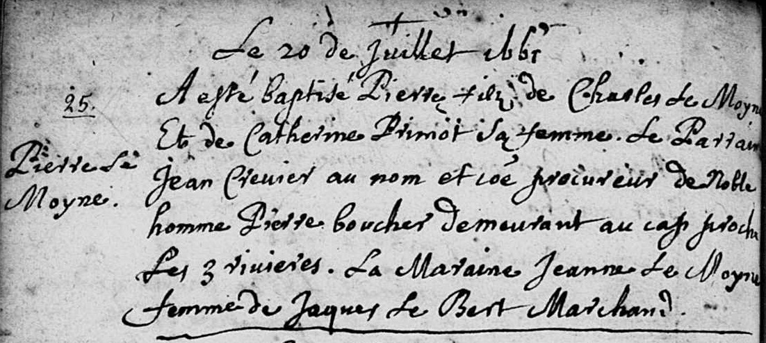 Document
Primary source
Baptismal Record of Pierre Le Moyne d'Iberville
Église catholique du Québec · 20 July 1661
 Book
Primary source
Histoire de l'Amérique septentrionale
Claude-Charles Le Roy de Bacqueville de La Potherie · 1722
 Diary entry
Primary source
Journal de l'expédition du chevalier de Troyes à la baie d'Hudson
Pierre de Troyes · 1686
 Artifact
Primary source
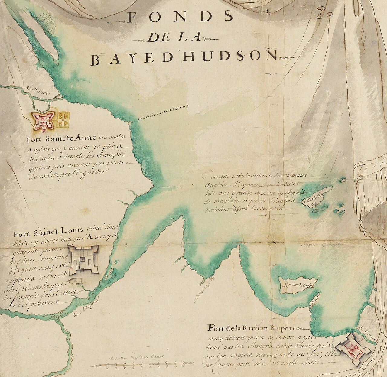
Fond de la baie d'Hudson avec les forts anglais pris par les Français en 1686
Pierre Allemand · 1686-1687
 Painting
Primary source
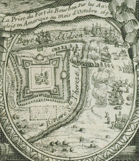
La prise du fort Bourbon dans la baie d'Hudson en 1694 par les Français
Nicolas Langlois · 1694
Ready when you are
Start chatting with Pierre Le Moyne d'Iberville now.
20 messages free · No credit card · Available in 50+ languages.