


Primary sourcePainting1589
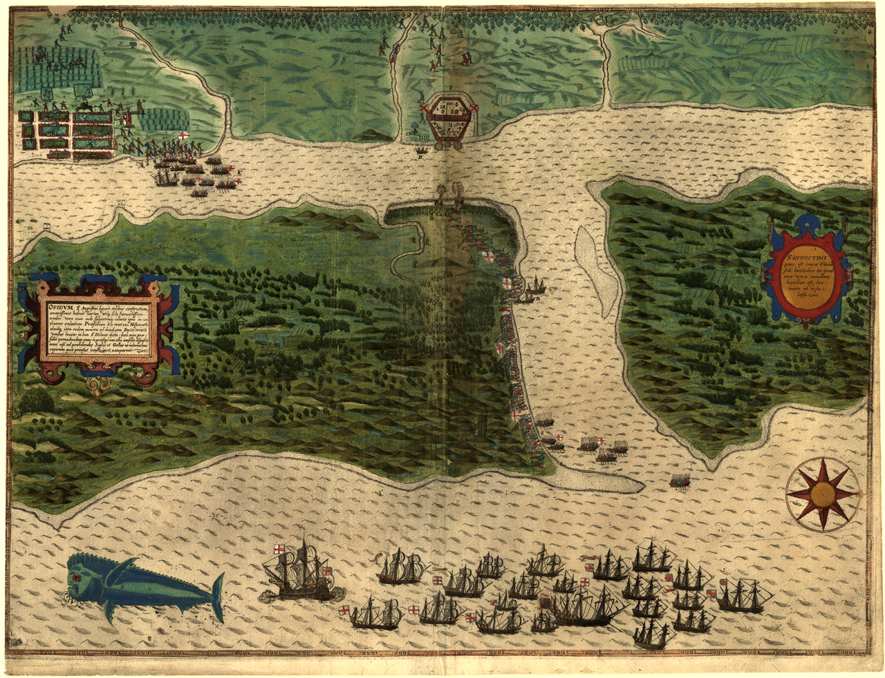
Map of St. Augustine, Florida
John White · 1589
An engraved map of the Spanish colony of St. Augustine, Florida, showing the kind of fortified settlement Juan Pardo's era helped build and defend.
This map shows St. Augustine, the fortified Spanish Florida world that Juan Pardo operated in, though Pardo is not depicted.
About this source
What it is
This is a colored engraving made in 1589, based on drawings connected to John White, showing the Spanish settlement of St. Augustine, Florida. It shows a fortified town, soldiers, ships, and a dorado fish copied from White's natural history drawings. It is considered the earliest engraving of any city or territory now part of the United States.
Why it matters
The map depicts a real event: Sir Francis Drake's 1585-86 raid on St. Augustine, showing troops landing, a fort under bombardment, and the Spanish garrison defending the settlement. Though it does not show Juan Pardo himself, it illustrates the small, fortified world of Spanish Florida that men like Pardo served and explored from. The accompanying text notes the Spanish kept garrisons there mainly to block English and French rivals, not for the land itself.
Look closer
- What details tell you this was a military and defensive settlement rather than a large town?
- Why would an English or French engraver want to make a detailed map of a Spanish fort?
- What is left out of the map that a Spanish soldier stationed there might have known?
This painting is part of the curated material that grounds the AI version of Juan Pardo on Humy.ai — when students ask about related events, the AI can quote it and cite it.
Ready when you are
Start chatting with Juan Pardo now.
20 messages free · No credit card · Available in 50+ languages.