


Primary sourceDocument1830 (this edition 1836)
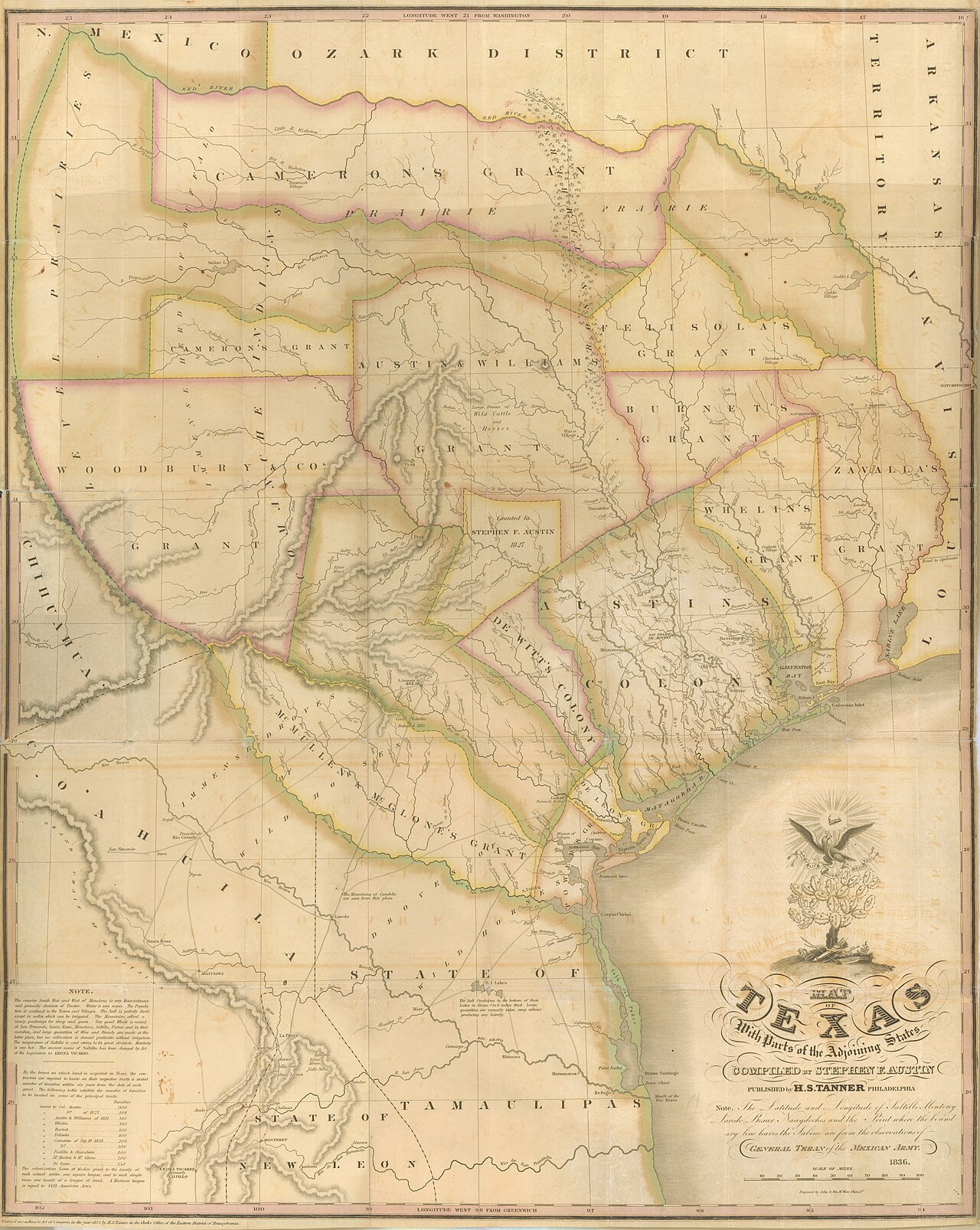
Map of Texas with Parts of the Adjoining States
Stephen F. Austin; Henry S. Tanner · 1830 (this edition 1836)
A detailed map of Mexican Texas compiled by Stephen F. Austin from his own surveys and published by Henry S. Tanner, used to promote colonization.
Austin compiled this map from his own surveys, making it a direct product of his work as empresario and colonizer.
About this source
What it is
This is a large hand-colored map titled 'Map of Texas with Parts of the Adjoining States,' compiled by Stephen F. Austin and published by Philadelphia mapmaker Henry S. Tanner. Austin finished his version in 1829, and Tanner's first printed edition appeared in 1830; this copy is a later 1836 edition. It is held today by the Texas General Land Office and the Library of Congress.
Why it matters
Compiling an accurate map was a requirement of Austin's contract with the Mexican government, and he drew on his own survey work as well as information from a Mexican government boundary commission. Once Tanner published it, the map became the most authoritative view of Texas available, helping attract immigrants to Austin's colony and shaping how outsiders understood Texas' rivers, land grants, and native peoples.
Look closer
- Why would an empresario like Austin want an accurate, published map of his colony?
- What details does the map include to encourage settlers, and what might it leave out about the land or its original inhabitants?
- How did the map's symbols change after Texas won independence from Mexico?
This document is part of the curated material that grounds the AI version of Stephen F. Austin on Humy.ai — when students ask about related events, the AI can quote it and cite it.
More Stephen F. Austin sources
Meet the AI Stephen F. Austin →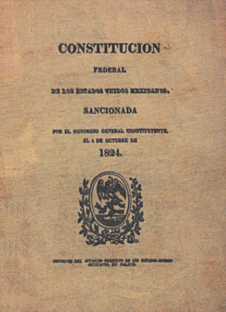 Document
Primary source
1824 Constitution of Mexico
First Constituent Congress of Mexico · 4 October 1824
 Painting
Primary source
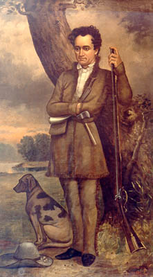
Stephen Austin and Dog
William Howard · 1833
Secondary source
Texas: Observations, Historical, Geographical and Descriptive
Mary Austin Holley · 1833
 Document
Secondary source
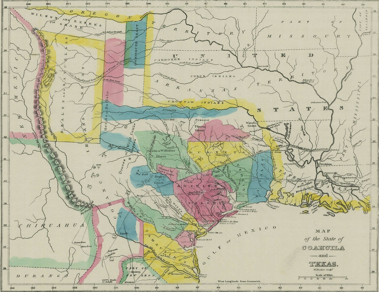
Map of Coahuila and Texas in 1833
Armstrong & Plaskitt (for Holley) · 1833
 Document
Primary source
Texas Declaration of Independence
George Childress · 2 March 1836
Ready when you are
Start chatting with Stephen F. Austin now.
20 messages free · No credit card · Available in 50+ languages.