


Primary sourceDocument1860
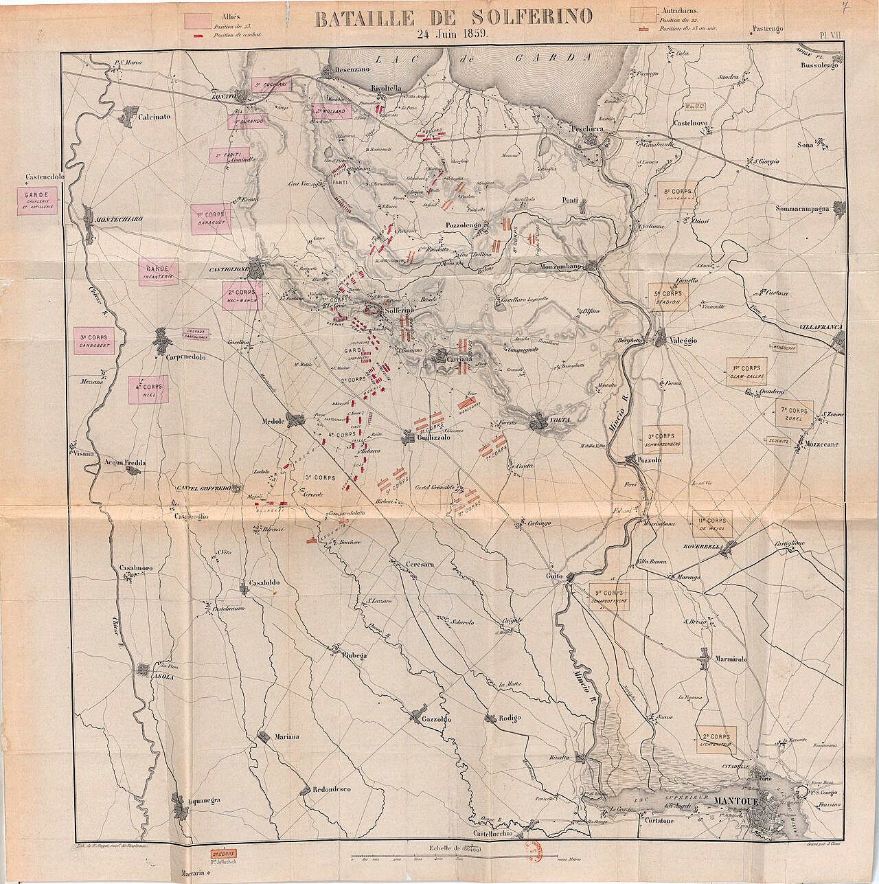
Plan of the Battle of Solferino (Van De Velde)
Van De Velde · 1860
A printed 1860 military map showing the terrain and troop positions at the Battle of Solferino, which Henry Dunant witnessed in 1859.
Shows the battlefield at Solferino that Dunant witnessed, the event that led him to found the Red Cross.
About this source
What it is
This is a printed battle plan made in 1860 by Lt-Colonel Van De Velde. It shows the terrain around Lake Garda and Mantua, with towns, roads and rivers, and marks the positions of the Allied and Austrian forces using coloured symbols.
Why it matters
The map documents the battlefield of Solferino, fought in June 1859, the event that Henry Dunant witnessed and that later inspired him to campaign for better treatment of wounded soldiers, leading to the founding of the Red Cross. Maps like this helped contemporaries and later readers understand how the battle unfolded.
Look closer
- What details does the map include, and what does it leave out, such as the human suffering after the battle?
- Why might a military mapmaker have created this soon after the battle?
- How might this map help explain why Dunant was shocked by what he saw?
This document is part of the curated material that grounds the AI version of Henry Dunant on Humy.ai — when students ask about related events, the AI can quote it and cite it.
More Henry Dunant sources
Browse all 81 →
Ready when you are
Start chatting with Henry Dunant now.
20 messages free · No credit card · Available in 50+ languages.