


Primary sourceDocument1860
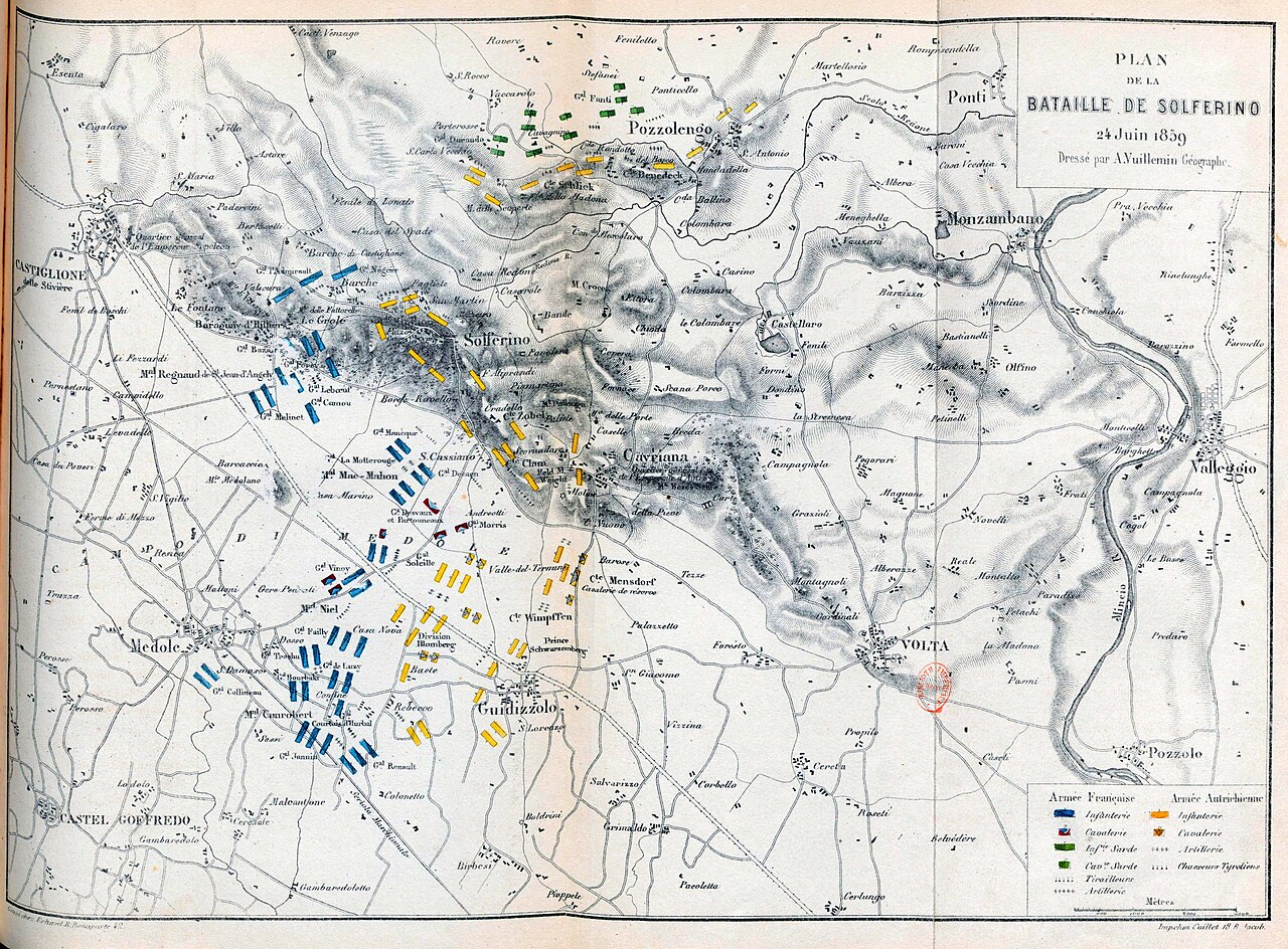
Plan of the Battle of Solferino (Vuillemin)
Gayet de Cesena, Amédée · 1860
A printed 1860 map of the Battle of Solferino, the battle that Henry Dunant witnessed and that inspired his humanitarian work.
Depicts the battlefield of Solferino that Dunant witnessed, prompting his founding of the Red Cross.
About this source
What it is
This is a printed map made in 1860 by A. Vuillemin, drawn by Amédée Gayet de Cesena. It shows hills and towns around Solferino with French and Austrian unit markers and a legend explaining the symbols.
Why it matters
The map records the Battle of Solferino of 1859, the bloody encounter that Henry Dunant witnessed as a traveller. His shock at the suffering of the wounded afterwards led him to write about the experience and to help found the Red Cross. Different makers produced similar battle maps soon after the event, showing how important the battle was considered.
Look closer
- Compare this map to another map of the same battle: what differences do you notice in how they show the armies?
- What is missing from this map that Dunant's own account would include?
- Why would publishers want to print maps of recent battles for the public?
This document is part of the curated material that grounds the AI version of Henry Dunant on Humy.ai — when students ask about related events, the AI can quote it and cite it.
More Henry Dunant sources
Browse all 81 →
Ready when you are
Start chatting with Henry Dunant now.
20 messages free · No credit card · Available in 50+ languages.