


Secondary sourcePhotographphotograph dated 14 July 2009
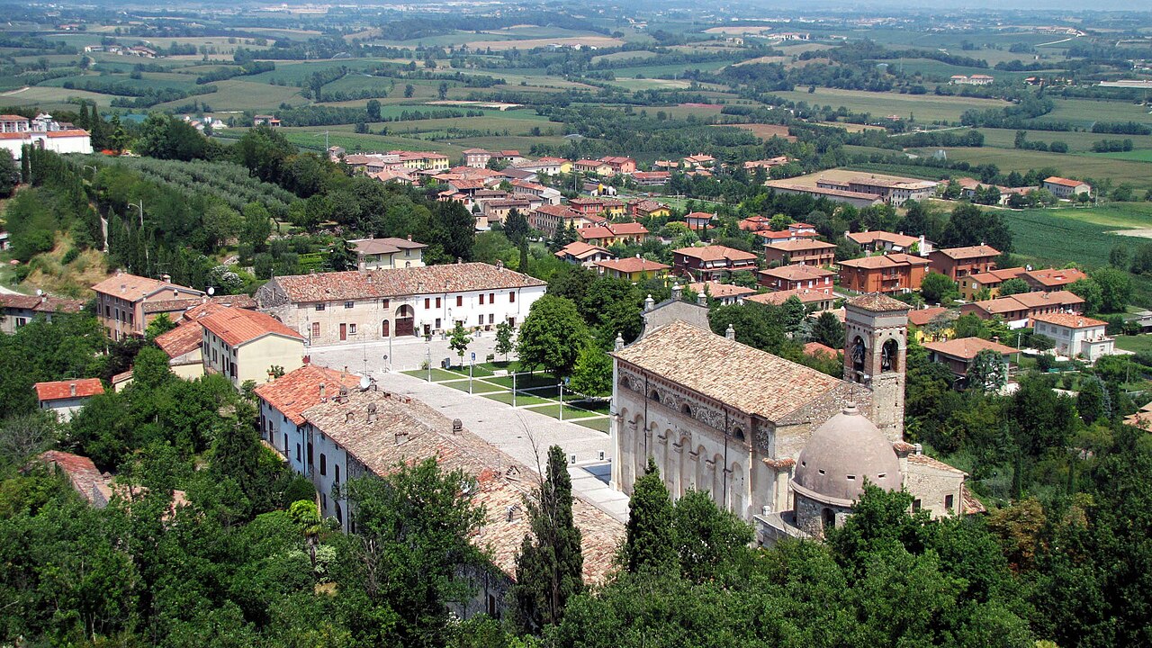
View of Solferino town and church
Murdockcrc · photograph dated 14 July 2009
A 2009 aerial photograph of the hilltop town of Solferino in Lombardy, Italy, where the battle that led Dunant to found the Red Cross was fought.
Shows Solferino, the site of the battle that led Dunant to found the Red Cross, the event that set his work in motion.
About this source
What it is
This aerial photograph, taken on 14 July 2009, shows the hilltop town of Solferino in Lombardy, Italy. It shows red-roofed buildings, a large church with a bell tower and a domed apse, a paved piazza with trees, and green fields stretching into the distance. The uploader is listed as Murdockcrc. The church shown is San Pietro in Vincoli.
Why it matters
Solferino was the site of the battle of the same name. The Commons description states that this battle was the trigger for Henry Dunant to found what is now known as the Red Cross. The photograph is a modern view, so it shows the town as it is today, not as it was during the battle in 1859.
Look closer
- What features of the town and its church would stand out to someone who came there after a battle?
- Why might the place of an event matter to the people who remember it?
- What does a single modern aerial view leave out about the battle and the people who fought in it?
This photograph is part of the curated material that grounds the AI version of Henry Dunant on Humy.ai — when students ask about related events, the AI can quote it and cite it.
More Henry Dunant sources
Browse all 81 →
Ready when you are
Start chatting with Henry Dunant now.
20 messages free · No credit card · Available in 50+ languages.