


Secondary sourceDocument27 May 2019
Hun Invasion of Gaul, 451
Игорь Васильев · 27 May 2019
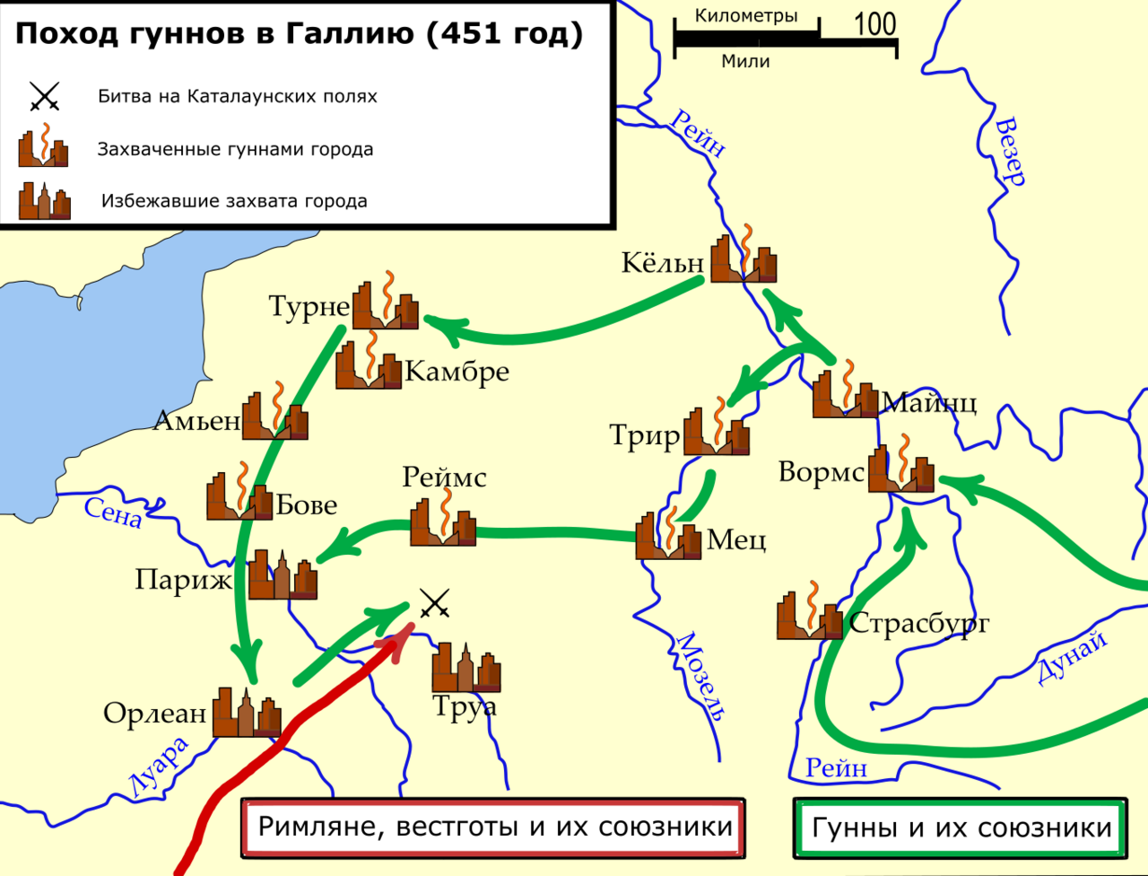
A modern Russian-language map of Attila's 451 campaign in Gaul, showing the route, captured and spared cities, and the Battle of the Catalaunian Plains near Troyes.
Traces Attila's route and the campaign he led into Gaul in 451, ending at the Battle of the Catalaunian Plains.
About this source
What it is
This is a modern map titled in Russian Поход гуннов в Галлию (451 год), meaning the Hun campaign into Gaul in 451. Green arrows trace the route from Strasbourg and the Rhine region west through cities such as Trier, Metz, Reims and Paris. Cities are marked as captured by the Huns or spared, and a red arrow shows the Roman, Visigoth and allied forces approaching from the southwest. A crossed-swords symbol marks the Battle of the Catalaunian Plains near Troyes. The map was created by Igor Vasilyev, the name given on the Commons record, and uploaded on 27 May 2019.
Why it matters
The map helps students follow the movement of Attila's army across northern Gaul and see where the armies met. It is a modern teaching map based on historical sources, not something made in the fifth century. Its legend shows the two sides as Huns and their allies, and Romans, Visigoths and their allies, which helps explain why the 451 campaign involved many peoples.
Look closer
- Which cities are marked as captured and which as spared, and what might explain the difference?
- Why does the map use arrows and symbols instead of showing the armies in detail?
- Whose point of view does the legend reflect, and which groups are described only as allies?
This document is part of the curated material that grounds the AI version of Attila the Hun on Humy.ai — when students ask about related events, the AI can quote it and cite it.
More Attila the Hun sources
Meet the AI Attila the Hun →
Ready when you are
Start chatting with Attila the Hun now.
20 messages free · No credit card · Available in 50+ languages.