


Primary sourceDocument1897
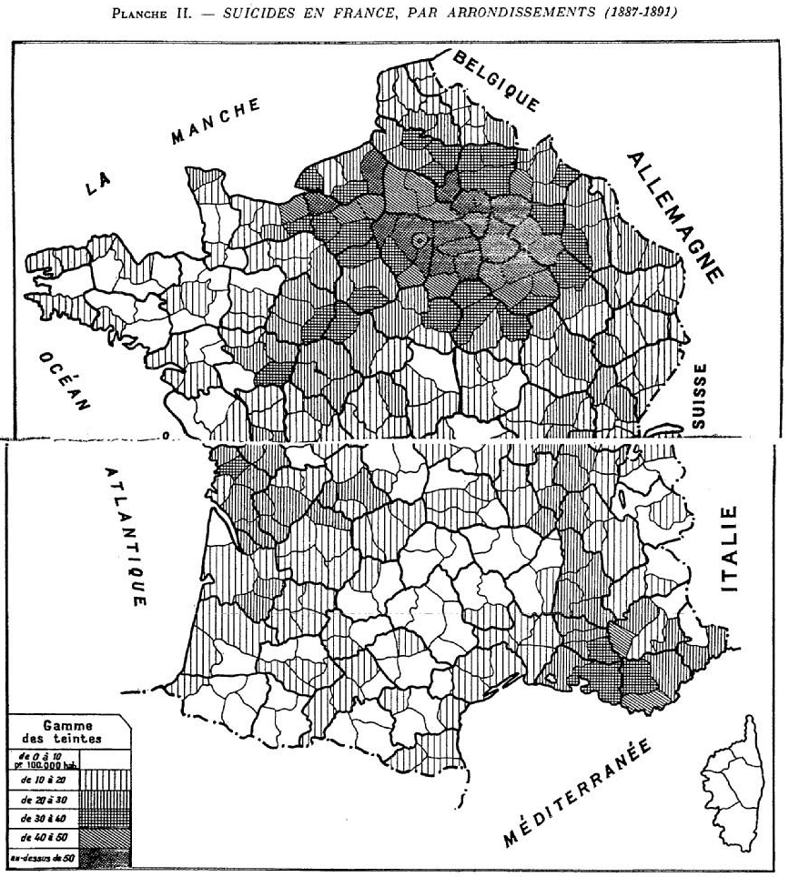
Suicide and Family Density Map
Émile Durkheim · 1897
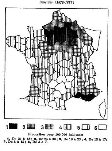
A statistical map from Durkheim's Suicide showing suicide rates across France compared to family density.
Durkheim created this map himself as evidence for his sociological theory of suicide.
About this source
What it is
This is a choropleth map made by Émile Durkheim for his book Le Suicide. It shades French departments by suicide rate per 100,000 people between 1878 and 1887, using six levels of shading to compare suicide with family density.
Why it matters
Durkheim used maps like this to prove that suicide is not just a private act but a social fact shaped by how tightly people are bound to family and community. This map supported his idea of "egoistic suicide" happening more where family ties were weaker.
Look closer
- Which regions are darkest, and what might that suggest about family life there?
- Why might a sociologist use a map instead of just numbers in a table?
- What information about individual people's lives is missing from a map like this?
This document is part of the curated material that grounds the AI version of Emile Durkheim on Humy.ai — when students ask about related events, the AI can quote it and cite it.
More Emile Durkheim sources
Browse all 59 → Book
Primary source
Suicide
Émile Durkheim · 1897
 Book
Primary source
The Division of Labour in Society
Émile Durkheim · 1893
 Book
Primary source
The Rules of Sociological Method
Émile Durkheim · 1895
 Book
Primary source
The Elementary Forms of the Religious Life
Émile Durkheim · 1912
Free account
Read every Emile Durkheim source
Sign up free →
Ready when you are
Start chatting with Emile Durkheim now.
20 messages free · No credit card · Available in 50+ languages.