


Secondary sourceDocument
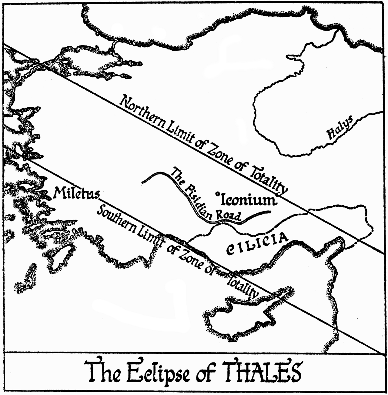
The Eclipse of Thales
John Knight Fotheringham
A scholarly diagram reconstructing the path of the eclipse that Thales is said to have predicted, used to help date his life.
This diagram reconstructs the eclipse Thales is said to have predicted, used by scholars to help date his life.
About this source
What it is
This map, created by astronomer John Knight Fotheringham and published in Historical Eclipses, shows the calculated path of totality of a solar eclipse across Asia Minor, including the region near Miletus.
Why it matters
Ancient tradition credits Thales with predicting a solar eclipse, an event later scholars have used to try to fix the approximate dates of his life and to study his scientific abilities. Fotheringham's diagram represents modern efforts to verify this ancient claim using astronomical calculation.
Look closer
- Why might scientists want to recreate an ancient eclipse using modern astronomy?
- What does it mean that this diagram was made centuries after Thales, based on calculation rather than direct observation?
- How might uncertainty in ancient sources affect how confidently historians can use this eclipse to date Thales' life?
This document is part of the curated material that grounds the AI version of Thales of Miletus on Humy.ai — when students ask about related events, the AI can quote it and cite it.
More Thales of Miletus sources
Browse all 76 → Book
Secondary source
Metaphysics
Aristotle · c. 400 BCE
 Book
Secondary source
Histories
Herodotus · c. 440 BCE
 Book
Secondary source
Theaetetus
Plato · early-to-middle 4th century BCE (this edition 1578)
 Book
Primary source
Politics
Aristotle · 4th century BCE
Free account
Read every Thales of Miletus source
Sign up free →
Ready when you are
Start chatting with Thales of Miletus now.
20 messages free · No credit card · Available in 50+ languages.