


Secondary sourceDocumentc. 500 BC (map subject); created 2018
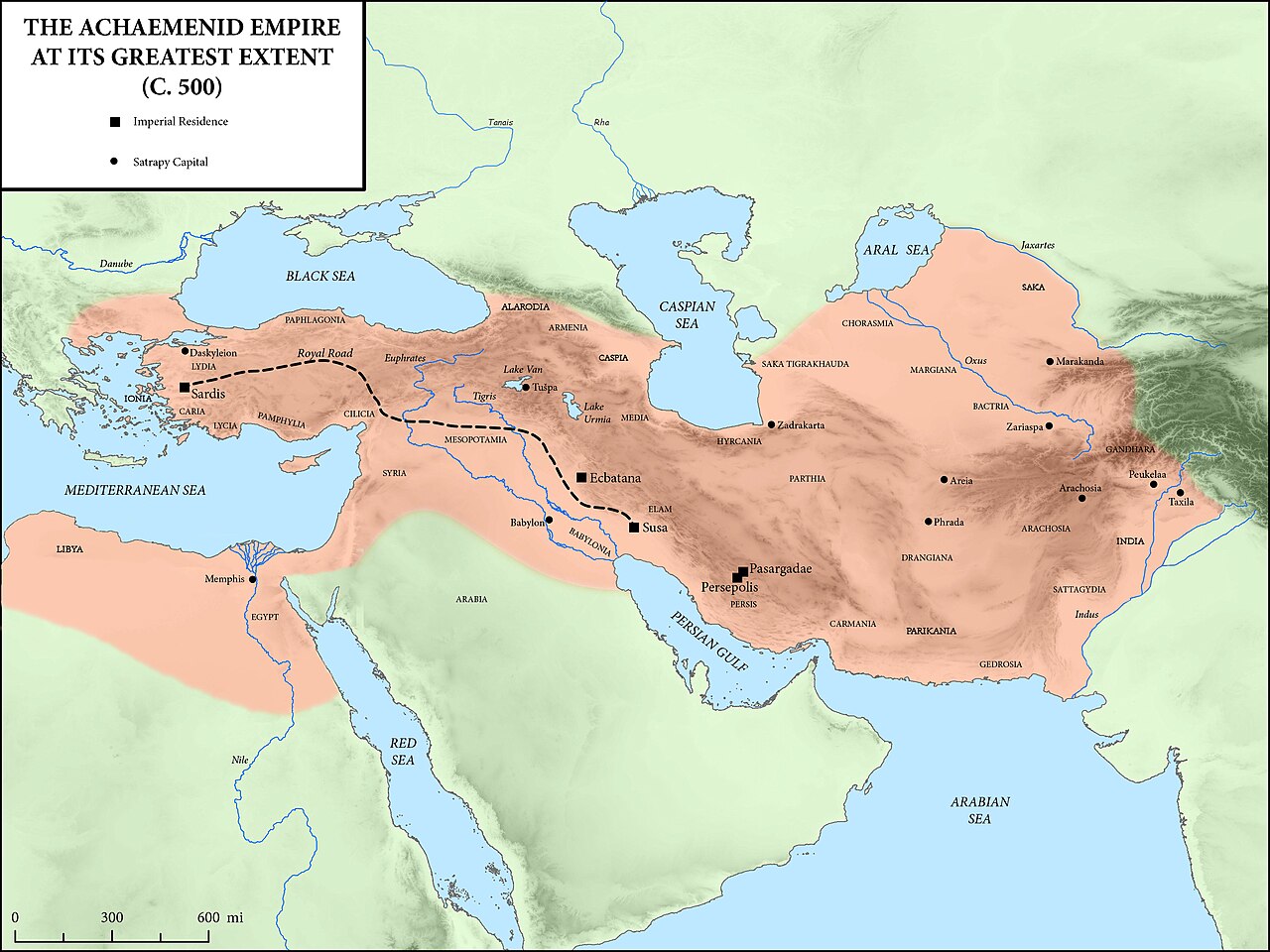
Achaemenid Empire at Its Greatest Extent
Mossmaps · c. 500 BC (map subject); created 2018
A modern map showing the Achaemenid Empire at its largest size, the territory Darius I ruled at the height of his reign.
This modern map shows the full extent of the empire Darius I ruled at its height.
About this source
What it is
This is a modern historical map, based on the Oxford Atlas of World History and other atlases, showing the Achaemenid Empire at its greatest extent around 500 BC. It shows the empire stretching from Greece and Egypt in the west to India and Central Asia in the east, with royal roads and imperial capitals marked.
Why it matters
This map helps show the huge scale of the empire that Darius I ruled and expanded. Understanding the geography helps explain the scale of administration, the road networks, and the challenges Darius faced in governing so many different peoples and regions.
Look closer
- What does the size of the empire suggest about the challenges of governing it?
- Why might marked roads and capitals matter for understanding how the empire worked?
- How might a map like this differ from maps made by Achaemenid Persians themselves?
This document is part of the curated material that grounds the AI version of Darius the Great on Humy.ai — when students ask about related events, the AI can quote it and cite it.
More Darius the Great sources
Meet the AI Darius the Great →
Ready when you are
Start chatting with Darius the Great now.
20 messages free · No credit card · Available in 50+ languages.