


Secondary sourceArtifact2007
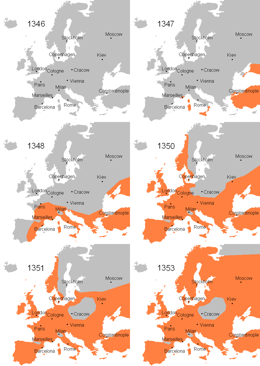
Black Death Strikes Europe, 1347-1353
ArdadN · 2007
A modern map showing the spread of the Black Death across Europe between 1347 and 1353, marking major cities.
A modern map illustrating how the pandemic struck cities across Europe.
About this source
What it is
This is a modern map uploaded in 2007 by a Wikipedia contributor, showing the spread of the Black Death across Europe from 1347 to 1353. It marks major cities including Stockholm, Copenhagen, Moscow, Kiev, London, Cologne, Cracow, Paris, Vienna, Milan, Marseilles, Barcelona, Rome, and Constantinople, with the year 1346 labeled in the upper corner.
Why it matters
By marking well-known cities across Europe, the map helps show how widely and quickly the pandemic reached across the continent, affecting communities from Scandinavia to the Mediterranean within just a few years.
Look closer
- What does the spread across so many distant cities suggest about how the disease traveled?
- Why might the mapmaker have chosen these particular cities to label?
- What information about the spread, such as dates for each city, is missing from this map?
This artifact is part of the curated material that grounds the AI version of The Black Death on Humy.ai — when students ask about related events, the AI can quote it and cite it.
More The Black Death sources
Meet the AI The Black Death →Secondary source
The Decameron
Giovanni Boccaccio · 1351
Primary source
Statute of Labourers 1351
1351
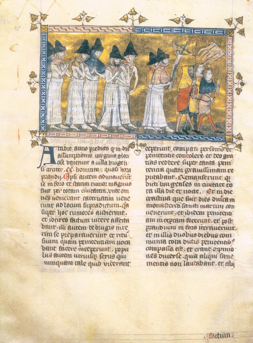 Painting
Primary source
Depiction of the Flagellant Processions
Pierart dou Tielt · c. 1350
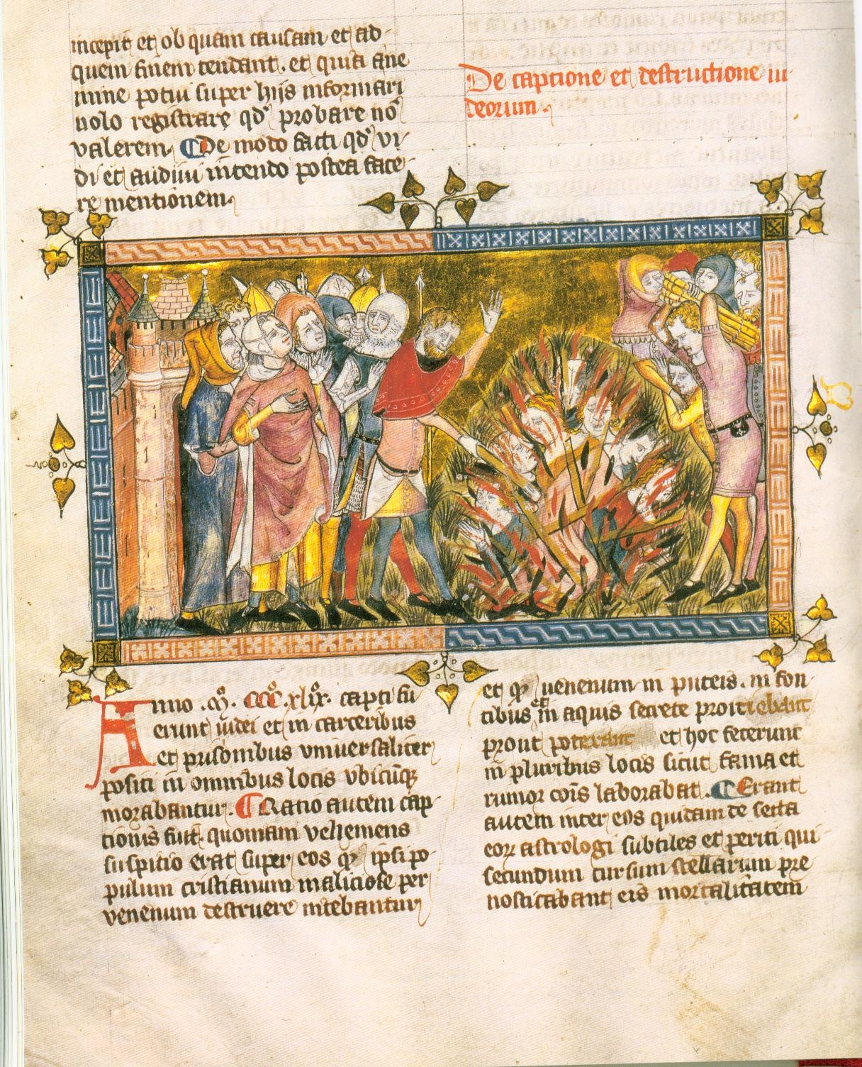 Painting
Primary source
Execution of Jews
c. 1350
 Book
Primary source
The Annals of Ireland by Friar John Clyn
John Clyn · 1348-1349
Ready when you are
Start chatting with The Black Death now.
20 messages free · No credit card · Available in 50+ languages.