


Secondary sourceDocumentc. 530-323 BCE (map subject); created 2018
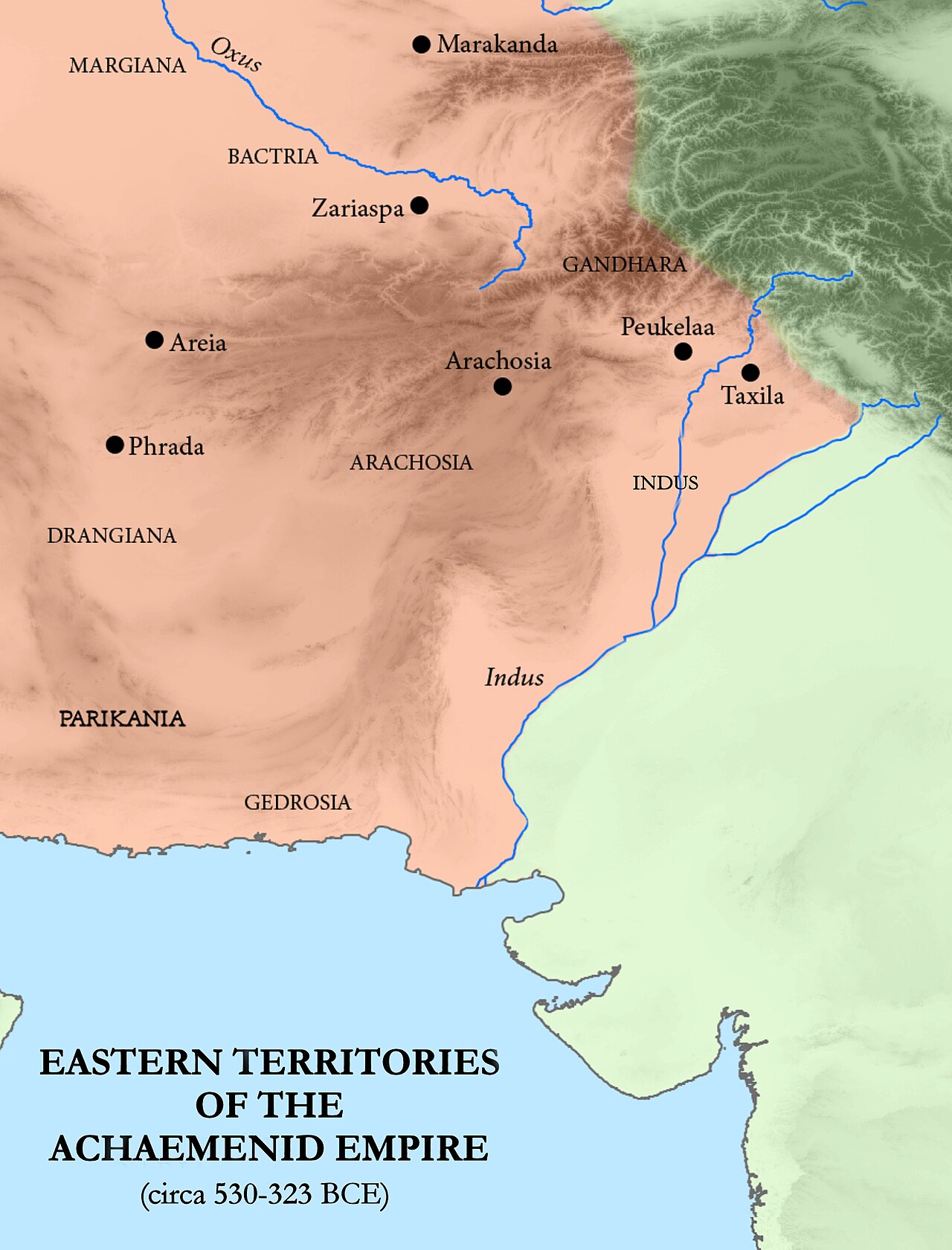
Eastern Satrapies of the Achaemenid Empire
Mossmaps · c. 530-323 BCE (map subject); created 2018
A modern map of the eastern provinces, or satrapies, that formed part of the administrative system Darius I organised.
This map shows the eastern satrapies, the provincial administrative system Darius I organised across his empire.
About this source
What it is
This is a modern shaded relief map showing the eastern satrapies, or provinces, of the Achaemenid Empire, including regions such as Bactria, Gandhara, and the Indus, dated broadly to circa 530–323 BC.
Why it matters
Darius I reorganised the empire into a system of satrapies, provinces each governed by an appointed satrap, to make ruling such a vast territory possible. This map shows the eastern half of that system, helping explain how Persian administration reached as far as the Indus River.
Look closer
- Why might a huge empire need to be divided into smaller provinces to be governed?
- What natural features, like rivers, might have shaped where satrapy borders were drawn?
- What does this map leave out about the people who actually lived in these regions?
This document is part of the curated material that grounds the AI version of Darius the Great on Humy.ai — when students ask about related events, the AI can quote it and cite it.
More Darius the Great sources
Meet the AI Darius the Great →
Ready when you are
Start chatting with Darius the Great now.
20 messages free · No credit card · Available in 50+ languages.