


Tertiary sourceArtifact28 September 2006 (original upload date)
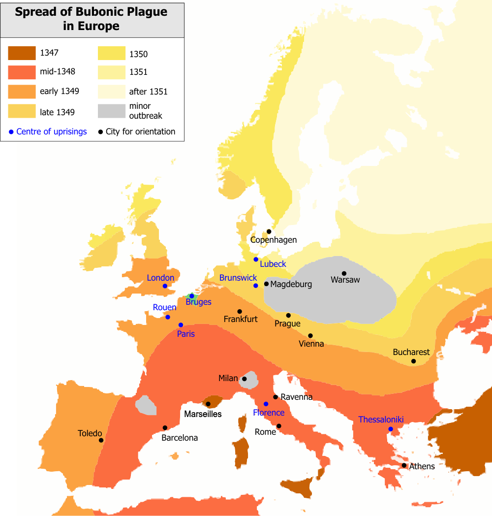
Map Showing the Spread of the Black Death from Asia towards Europe
Bunchofgrapes · 28 September 2006 (original upload date)
A modern map tracing the pandemic's path from Asia into Europe, with regions colored by year of arrival.
This map illustrates the geographic spread of the Black Death pandemic from Asia into Europe.
About this source
What it is
This is a modern map created to show how the Black Death spread from Asia into Europe. Regions of Europe are colored according to the year the plague reached them, from 1347 through the early 1350s, with markers for cities and for places where uprisings occurred.
Why it matters
Maps like this help historians and students understand the scale and speed of the pandemic, which killed enormous numbers of people across Eurasia in just a few years. The map also hints at the social unrest that followed, marked by the blue dots showing uprisings.
Look closer
- What does the pattern of colors tell you about how quickly the plague spread?
- Why might certain areas have been reached later than others?
- What is missing from a map like this that a written account might capture—such as human suffering or daily life?
This artifact is part of the curated material that grounds the AI version of The Black Death on Humy.ai — when students ask about related events, the AI can quote it and cite it.
More The Black Death sources
Browse all 73 →Secondary source
The Decameron
Giovanni Boccaccio · 1351
Primary source
Statute of Labourers 1351
1351
 Painting
Primary source
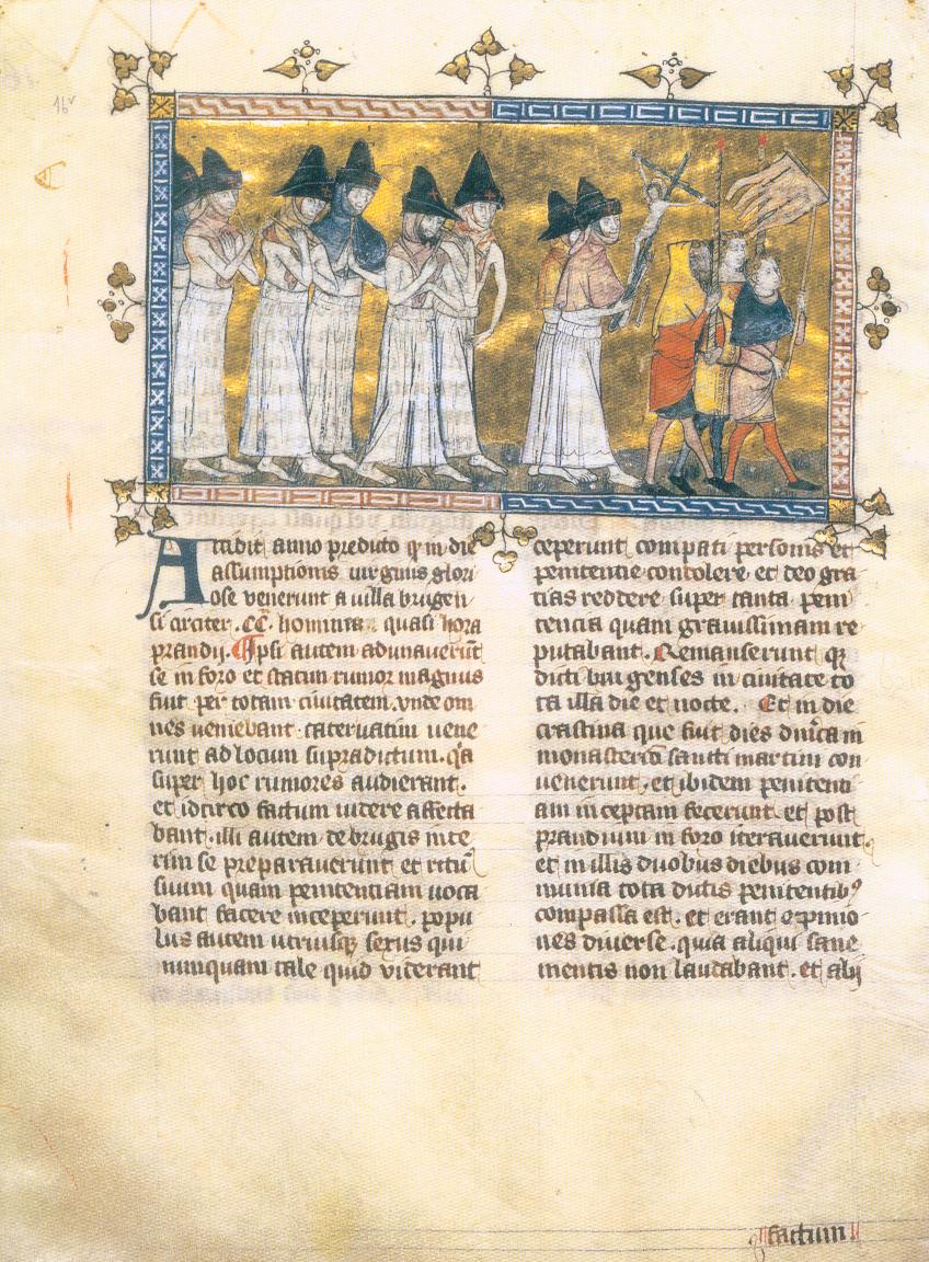
Depiction of the Flagellant Processions
Pierart dou Tielt · c. 1350
Primary source
Execution of Jews
c. 1350


Free account
Read every The Black Death source
Sign up free →
Ready when you are
Start chatting with The Black Death now.
20 messages free · No credit card · Available in 50+ languages.