


Secondary sourceArtifactc. 150 AD (reconstructed after 1295)
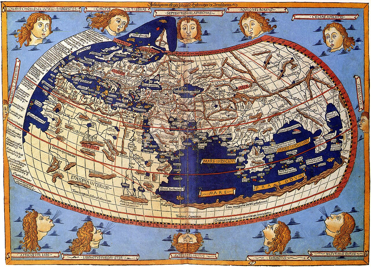
Ptolemy's World Map
Ptolemy · c. 150 AD (reconstructed after 1295)
A reconstructed map of the world as described in Ptolemy's Geography, showing the Greco-Roman view of the inhabited earth.
A later reconstruction of the map described in Ptolemy's own text, showing his vision of the known world.
About this source
What it is
This map reconstructs the world as described in Ptolemy's Geography, written around AD 150. No original maps by Ptolemy survive; this version was recreated from his coordinates by Byzantine monks under Maximus Planudes shortly after 1295, and later versions, like this hand-colored 1482 printed edition, descend from that reconstruction. It is traditionally credited in part to Agathodaemon of Alexandria.
Why it matters
The map was the first to use a system of longitude and latitude based on celestial observation, a huge step for cartography. It shaped European ideas of the world's shape and size, including an enclosed Indian Ocean, and influenced expectations before later voyages of exploration. It shows both the scientific ambition and the real limits of ancient geographical knowledge.
Look closer
- Why is this called a 'reconstruction' rather than Ptolemy's original map?
- What parts of the world look distorted or missing compared to a modern map?
- How might a coordinate system change the way people imagine the world?
This artifact is part of the curated material that grounds the AI version of Ptolemy on Humy.ai — when students ask about related events, the AI can quote it and cite it.
More Ptolemy sources
Browse all 99 →
Ready when you are
Start chatting with Ptolemy now.
20 messages free · No credit card · Available in 50+ languages.