


Primary sourceArtifact1595
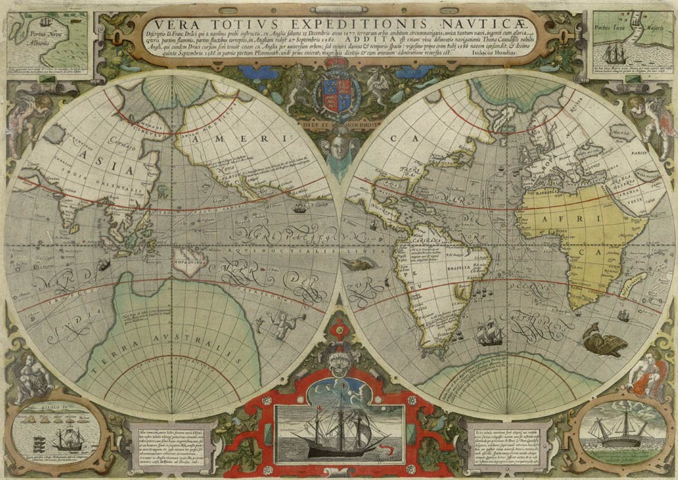
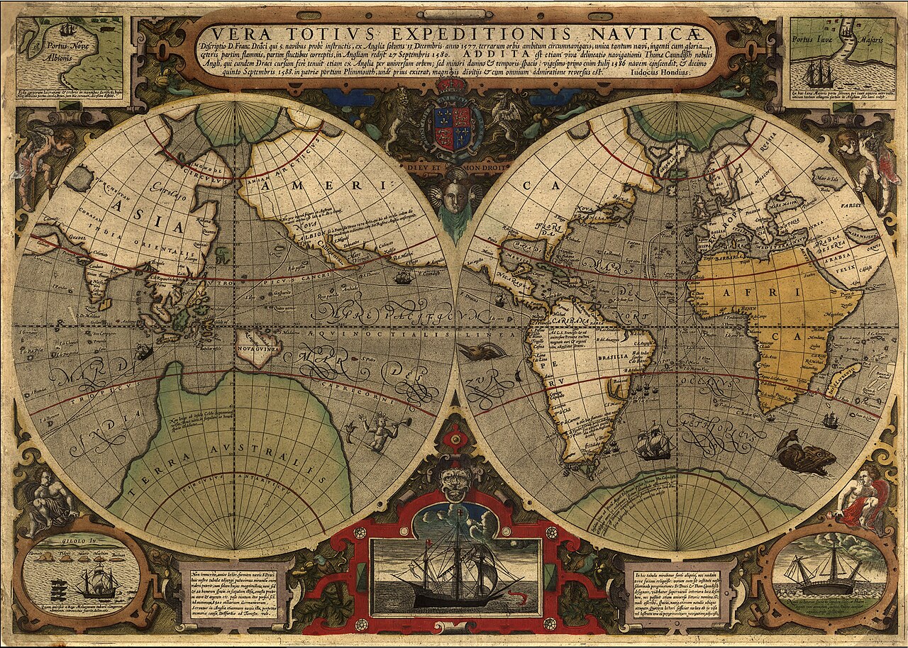
Vera Totius Expeditionis Nauticae
Jodocus Hondius · 1595
A coloured map by Jodocus Hondius showing the route of Drake's circumnavigation of the globe.
This map traces Drake's own route around the globe during his famous circumnavigation.
About this source
What it is
This coloured world map, titled Vera Totius Expeditionis Nauticae, was engraved by Jodocus Hondius in 1595. It shows the sea routes of Francis Drake's voyage around the world, decorated with cartouches, ships, and sea monsters.
Why it matters
Maps like this celebrated Drake's circumnavigation as a landmark achievement in European exploration. They also show how cartographers of the time combined real navigational knowledge with decorative imagination, and how England's rivalry with Spain was tied to maritime exploration.
Look closer
- Why do you think the map includes decorative sea monsters and ships?
- What does the map's accuracy (or inaccuracy) tell us about geographic knowledge in the late 1500s?
- Why might mapmakers have wanted to highlight Drake's route specifically?
This artifact is part of the curated material that grounds the AI version of Sir Francis Drake on Humy.ai — when students ask about related events, the AI can quote it and cite it.
More Sir Francis Drake sources
Meet the AI Sir Francis Drake →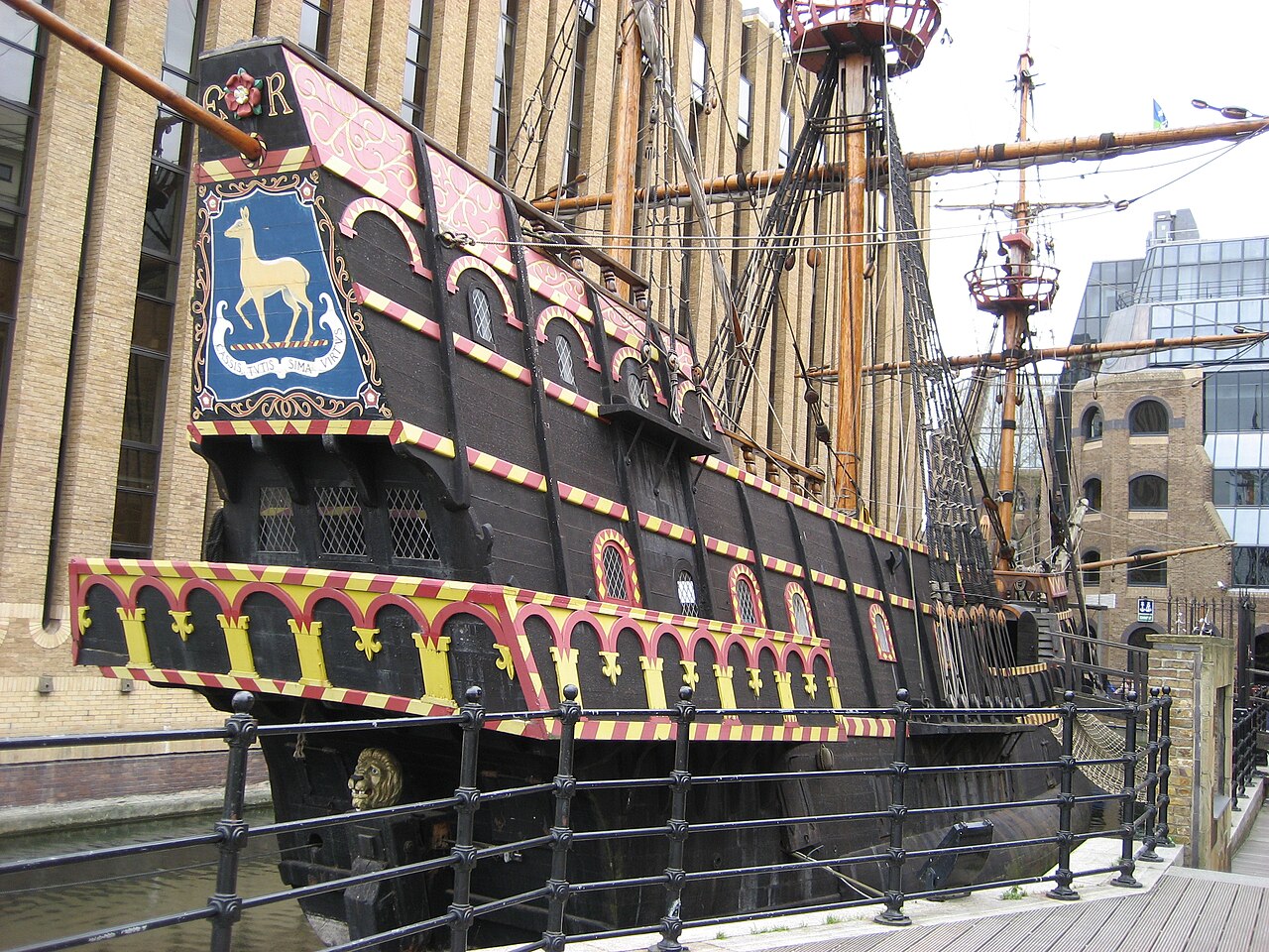 Artifact
Secondary source
Golden Hind
1575 (as Pelican); renamed 1578
 Painting
Primary source
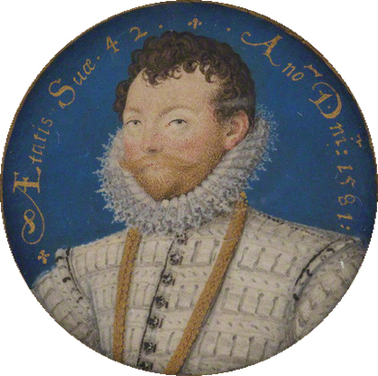
Sir Francis Drake
Nicholas Hilliard · 1581
 Painting
Primary source
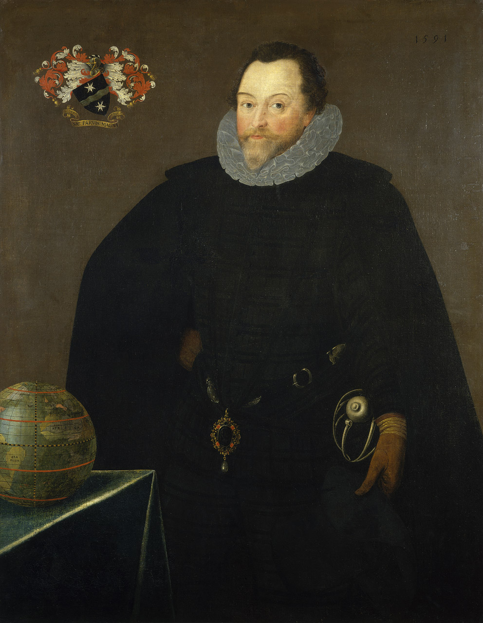
Sir Francis Drake, 1540-96
Marcus Gheeraerts the Younger · 1591
 Document
Secondary source
Vera Totius Expeditionis Nauticae
Jodocus Hondius I · 1595
 Painting
Primary source
Armada Portrait
Unknown English artist · 1588
Ready when you are
Start chatting with Sir Francis Drake now.
20 messages free · No credit card · Available in 50+ languages.